Our archive and search room is now open on Tuesdays and Thursdays from 10am to 4pm. Keep up to date via our Facebook page and Twitter.
Tweedsmuir
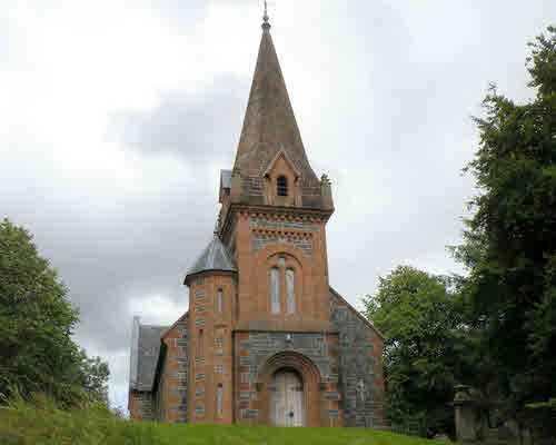
Tweedsmuir is the most southern parish in the County of Peebles. It is bordered on three sides by neighbouring counties - the parish of Yarrow in Selkirkshire to the east, Dumfriesshire to the south and Lanarkshire to the west. To the north Tweedsmuir is linked to the rest of Peebleshire by the parish of Drumelzier. Tweedsmuir is situated at the head of Tweeddale; Tweed's Well, the source of the River Tweed, is at the southern tip of the parish close to the point at which the counties of Peebles, Dumfries and Lanark meet. It is now one of the linked Parishes of Upper Tweeddale.
Old Parish Records cover the periods:
Births: 1644-1697, 1720-1854 (Mothers' names are not recorded until September 1762)
See our sales list for full details and cost of postage.
Volumes available for consultation within our Archive
Pre 1855 Monumental Inscriptions of Peeblesshire by S.A. Scott published by Scottish Genealogical Society 1971.
Rutherford's Southern Counties Register and Directory 1867.
County Directory of Scotland 1912 - Borders Towns and Villages.
CD-ROM Extracts from the Records of the Burgh of Peebles 1652 to 1716.
Andrew Lorimer's Life and Times in the Upper Tweed Valley by Margaret Railton, Tuckwell Press, East Linton 2001
Magazine Articles
Please note that the heading Author includes persons who have compiled or transcribed records; and that the topics indexed, and the synopses are subjective opinions. See the Sales List to buy copies of the magazines containing articles in which you're interested.
Title
Synopsis
Size Description
Issue No
Author
Know Your Parish - Tweedsmuir
History of the parish of Tweedsmuir, and notable people. Drawing of Polmood in ruins.
2 pages or more
23
Jean Moffatt
The Tweedsmuir Sacrifice
An account of the sacrifices and losses of the Parishioners of Tweedsmuir during W.W.1. and of one family in particular.
2 pages or more
96
Ian Renwick
The Tweedsmuir Connection
Report of the society's summer outing to Upper Tweeddale.
1 page or more
13
Violet Jardine
List of covenanters in the Parish of Tweedsmuir in 1682, as compiled by Mr Francis Scott, minister
An account with list of Covenanters in Tweedsmuir in 1682.
3 pages or more
94
Francis Scott
Covenanting Grave, Tweedsmuir
Notes on the grave in Tweedsmuir, of the Covenanter, Thomas Hunter.
less than 1 page
98
The Wild Bunch
History of the Tweedie clan. Includes line drawings of ruins of Tinnies and Drumelzier castles.
4 pages or more
24
Norrie McLeish
Hope Family
Link to the website of the Hope family of Traquair, Tweedsmuir and West Calder.
less than 1 page
98
Grandpa Johnston's Reminiscences
A consolidated reflection of the account of his heritage and the recollections by James Johnston(e) (1825-1902) a blacksmith born in Tweedsmuir, and who died in Edinburgh. He traced is family back to the 17th century, with many forefathers buried in Drumelzier, with most men working as smiths in Tweedsmuir. James was sent to school 2 miles away in Tweedsmuir, with peat the primary fuel. The Crook Inn was the main posting and coaching stop between Edinburgh and Dumfries. There are tales of problems with the post in bad weather, and of the families running the Crook Inn. The Johnston family moved to Eddleston in 1838 with stories about the journey and the celebrations of the coronation of Queen Victoria. James moved to the school in Eddleston, with a very strict approach compared to Tweedsmuir. The family had to relocate to Macbiehill as the leaseholder re-took possession of the smiddy. Linton was the next location, and then training in Edinburgh as a veterinarian. In the late 1800s many of the family, including James's wife, son and daughter died from different afflictions. Based on transcripts sent to the Editor by Kath Baines.
6 pages or more
107
Editor
William Shillinglaw Crockett
Article on William Shillinglaw Crockett, Earlston, minister, poet and public speaker.
1 page or more
99
Jenny Cockburn
Map of Tweedsmuir from UK Great Britain, Ordnance Survey one-inch to the mile (1:63,360), 'Hills' edition, 1885-1903 by kind permission of the National Library of Scotland. Use the control at the top left of the map to zoom in or out and drag the map left, right, up, or down as you wish.
Map of Tweedsmuir from UK Ordnance Survey Historical Maps from 1919-1947 by kind permission of the National Library of Scotland. Use the control at the top left of the map to zoom in or out and drag the map left, right, up, or down as you wish.
Other Sources
The Buildings of Scotland - Borders, Cruft, Dunbar & Fawcett, Yale University Press, London 2006
The Statistical Accounts of Scotland compiled initially between 1791 and 1799, with a subsequent edition between 1834 and 1845 are a valuable record of the geography, history, economy, people and customs recorded by local ministers. You'll need to search for the parish name.