Our archive and search room is now open on Tuesdays and Thursdays from 10am to 4pm. Keep up to date via our Facebook page and Twitter.
Edgerston
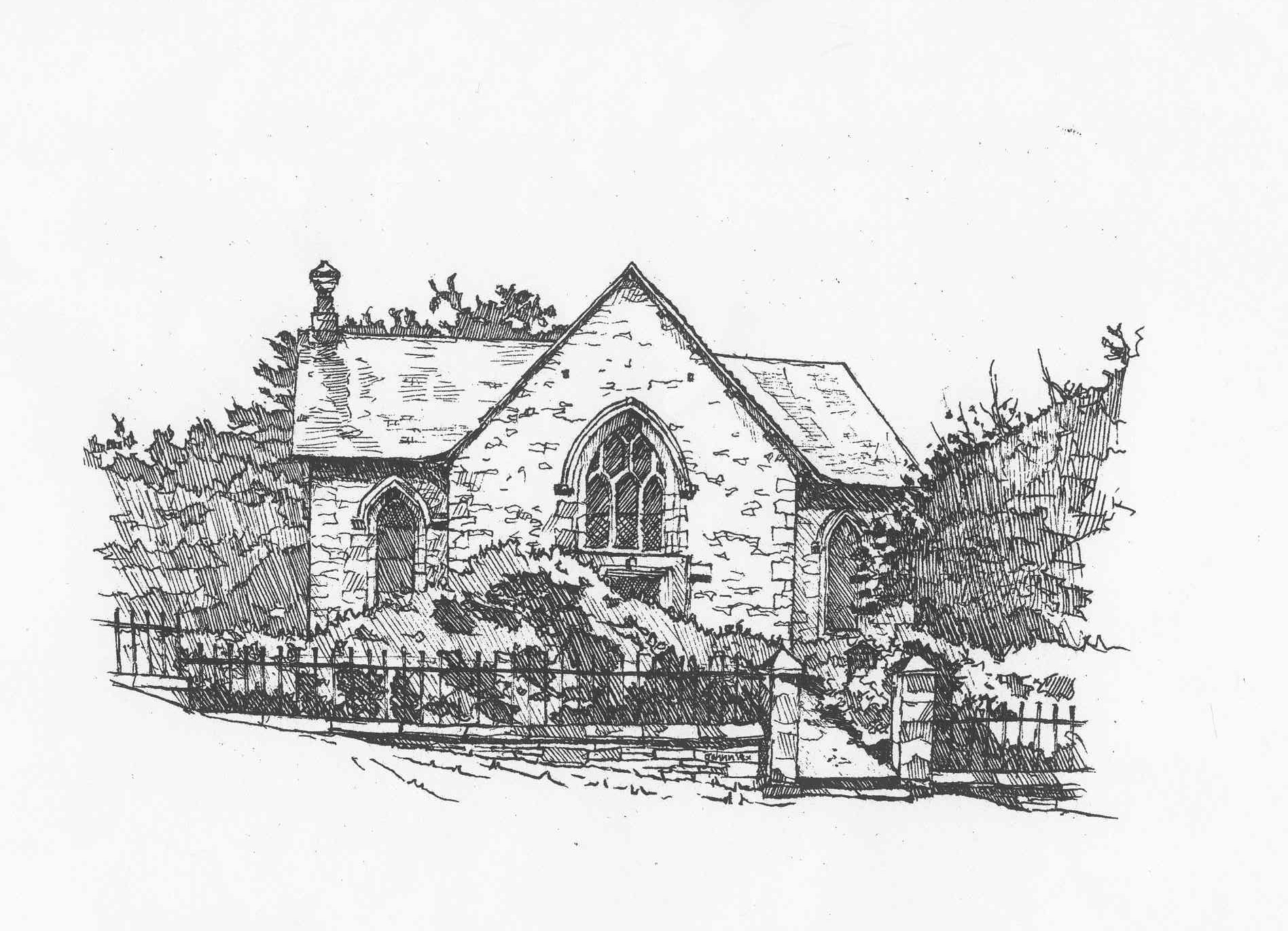
Edgerston is a quoad sacra Parish which lies on the English Border between the Parishes of Southdean & Abbotrule on the west, Jedburgh to the north and Oxnam to the east. The parish was formed in 1855 from part of the Parish of of Jedburgh with which it has once more been combined. The road north from Newcastle crosses into Scotland at Carter Bar which is in the Parish.
For Old Parish Birth, Marriage and Death records see Jedburgh
Roxburghshire Monumental Inscriptions no 15 1999 Edgerston by Elspeth Ewan - inclues:
Hearth Tax
Militia List
List of Ministers
War Memorial Transcriptions
See our sales list for full details and cost of postage.
Volumes available for consultation within our Archive
The Churches and Graveyards of Roxburghshire by Dr. G.A.C. Binnie 2001.
Rutherford's Southern Counties Register and Directory 1867.
County Directory of Scotland 1912 - Borders Towns and Villages.
CD-ROM Pigot's 1837 Directory of Berwickshire and Roxburghshire.
CD-ROM Land Ownership Commission Report 1872 -1873.
Magazine Articles
No articles currently.
Map of Edgerston from UK Great Britain, Ordnance Survey one-inch to the mile (1:63,360), 'Hills' edition, 1885-1903 by kind permission of the National Library of Scotland. Use the control at the top left of the map to zoom in or out and drag the map left, right, up, or down as you wish.
Map of Edgerston from UK Ordnance Survey Historical Maps from 1919-1947 by kind permission of the National Library of Scotland. Use the control at the top left of the map to zoom in or out and drag the map left, right, up, or down as you wish.
20 Most Common Surnames
The 20 most common surnames on gravestones recorded by us in the Edgerston monumental inscriptions volume are (number of gravestones in brackets): OLIVER (16), SCOTT (15), RUTHERFORD (12), ELLIOT (8), RENWICK (7), HALL (7), DICKSON (4), TAYLOR (4), BELL (4), TELFER (3), JACKSON (3), UMPHERSTON (3), MCGLASSON (3), KERR (3), MCINTOSH (3), HEDLEY (3), AMOS (2), DALGLEISH (2), PURVES (2), SHARP (2).