Our archive and search room is now open on Tuesdays and Thursdays from 10am to 4pm. Keep up to date via our Facebook page and Twitter.
Duns
formerly Dunse
The Parish of Duns lies in central Berwickshire, being bounded on the north by the Parishes of Cranshaws and Abbey St. Bathans, the Parish of Bunkle and Preston is to the east, the Parish of Edrom is to the east and south and the Parishes of Langton and Longformacus are on the west.
Old Parish Records cover the periods:
Births: 1615 to 1854.
Marriages: 1797 to 1854.
Deaths: 1796 to 1816 and 1822 to 1854
Death records from 1797 to 1854 have been indexed.
Full of Egotism - the Diary of the Rev. John Hastie minister Edrom 1797-1822 edited by Ronald Morrison.
Dunse Barony Records 1753 -1800 transcribed by Ronald Morrison.
Maps 1898 O.S Duns and Greenlaw.
Duns Monumental Inscriptions Vol. 17 Berwickshire: includes
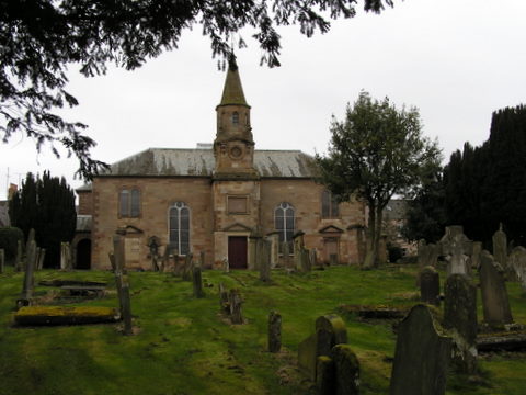
Parish church burial ground and memorial plaques
Christ Church, Teindhillgreen burial ground
Hearth Tax
Militia List
Lists of Ministers of various churches in the town
Duns War Memorial
War Memorial 1914 -1919
Roll of Honour
See our sales list for full details and cost of postage.
Volumes available for consultation within our Archive
The Street of Duns by William Renton published by the Berwickshire News.
The Churches and Churchyards of Berwickshire by G. A. C. Binnie.
The Macks of Ninewar 1752 to 1800 by E.O. Hooton.
Berwickshire High School - a Century Recalled 1896-1996 by William Anderson.
Extract from Records of Skinners and Glovers by R.G. Johnson (Berwickshire Naturalists' Club Vol. 33).
Historical Diary of James Watson, writer Duns 1780 to 1868 (contains Watson pedigree), Grace A Elliot (Berwickshire Naturalists' Club Vol. 38).
The Cholera Epidemic of 1832 in Duns and the Borders, Sheila Romanes (Berwickshire Naturalist's Club Vol 46).
A History of the Churches in the Presbytery of Duns (Berwickshire Naturalist's Club Vol 46).
Castles of the Cockburns - a history of the family's ownership of Langton Castle, Cockburn Tower, Borthwick Castle and Langton Tower, LH. Cleat (Berwickshire Naturalists' Club Vol 47).
Dr. John Brown 1735 to 1787, Dr. Brian Sproule (Berwickshire Naturalists' Club Vol 47).
1961 The Hiring Fair, Rachel Weir (The Southern Annual, 1961)
Pre 1855 Memorial Inscriptions of Berwickshire, David Cargill (Scottish Genealogical Society).
Index to Particular Register of Sasines for Berwickshire.
Pigot's 1837 Directory of Berwickshire and Roxburghshire.
Rutherford's Southern Counties Register and Directory 1867.
County Directory of Scotland 1912 - Borders Towns and Villages.
CD-ROM The Churches and Churchyards of Berwickshire by James Robson 1896.
CD-ROM Slater's Directory of Berwickshire 1903.
CD-ROM Land Ownership Commission Report 1872 -1873.
Magazine Articles;
Please note that the heading Author includes persons who have compiled or transcribed records; and that the topics indexed, and the synopses are subjective opinions. See the Sales List to buy copies of the magazines containing articles in which you're interested.
Title
Synopsis
Size Description
Issue No
Author
Border Murders
This is a stroll around the Borders looking into, with some depth, the murders in the 1800s.
2 pages or more
32
Norrie McLeish
Who am I
History of the Cockburns who all came from Duns parish. It also looks into the history of Edinshall Broch.
1 page or more
37
Andrew Cockburn
John Duns Scotus
A mention of events to commemorate the 750th. Anniversary of the birth of John Duns Scotus, genealogy research and the seeking of a possible DNA connection.
1 page or more
89
Ronald Morrison
Duns, Burgh on the Merse and Surrounding Villages
Review of the book Dunse Burgh on the Merse with the Surrounding Villages' by James Denham.
1 page or more
91
Duns Associations
A detail of different Associations and Societies in Duns with dates of incorporation.
less than 1 page
95
Duns 700
A summary of the origin of the 700th anniversary of the granting of a Charter to Randolph, Earl of Moray, of the lands of Duns, by his uncle King Robert the Bruce. Randolph initiated the building of Duns Castle and effectively giving rise to the town. It is acknowledged the Iron Age fort (before 1320), and the Franciscan scholar Duns Scotus pre-date this. The Duns 700 coincides with the 200th anniversary of the Town Hal (now demolished). Preston Road Monumental Inscriptions, 1821 population list, militia lists, Church of Scotland and Duns Kirk communicants, plus custody records will be available.
1 page or more
102
Ronald Morrison
Dunse Mystery Photo
A request to identify the people in a postcard taken in Duns(e). Thought to be prior to 1882.
less than 1 page
103
Editor
Southfield House and The Knoll
Book review. Author: David McLean. Histories of 2 properties in Duns. Southfield House (now Southfield Community Centre) - Robson family, and The Knoll (now The Knoll Medical Centre) - Wilson family. Digital copies available.
less than 1 page
106
Ronald Morrison
Duns Properties and Families
Book review. Author: David McLean. Histories of 3 further properties in Duns. 1. The Hermitage on Station Road - built 1840 - previously families Stewart/Stuart and Ferguson - nursing home - and now in private hands again. 2. Duns Auction Mart - opened 1877 - main family connection - Swan. 3. Fenton Lodge (previously Kilmeny) - 1890s designed by local architect George Fortune (also known for local churches - especially new church at Cranshaws - related families Fensons and Robsons. Digital copies available. See also Issue 106.
less than 1 page
107
Ronald Morrison
Duns Title Deeds
A summary of the extensive property portfolio of the Watson family in Duns in the 18th and 19th centuries, recorded in a collection of 17 deeds, hand written, bound and indexed by solicitors in the Watson family. Adjoining proprietors are also recorded.
less than 1 page
108
Ronald Morrison
Duns Properties and Families
Book review. Author: David McLean. History of 1 further property in Duns. A description of Wellnage, a grand early 19th century house, and 2 families that resided there (the Peats, the original owners, and their successors, the Wilsons). Digital copy available. See also Issue 106 and Issue 107 for other properties.
less than 1 page
109
Ronald Morrison
Cockburns face to face
Cockburns and their likeness seems to have been the great asset of this family. From 1650 onwards this family have a interesting history.
2 pages or more
10
Anne Cockburn
Hunters of Duns
Detailed article on the history of the Hunter family of Duns and their involvement in the American War of Independence.
3 pages or more
94
David J Wesley
Edrom and Preston Road, Duns burials
Report of a donation to the Society of copy records relating to burials at Edrom Churchyard and Preston Road, Duns Churchyard.
less than 1 page
96
The Soldiers Remember
Report on launch of the book 'The Soldiers Remember' being of memories recorded by wounded soldiers during WW1 as they recovered at Southfield Military Hospital, Duns.
less than 1 page
97
Murder Most Foul
The story of a murderer John Newbigging (born Duns 1871) who married Margaret White from Eyemouth. He killed his wife and 4 children in Lanark Lodge in Duns assessed as due to 'homicidal mania'.
1 page or more
103
Ronald Morrison
The Berwickshire Leitchs Part 1
Research into the ancestors of the author's husband David Leitch. Two groups of the Leitch families were revealed - 1 from Glasgow and Argyll area and a group from the Borders, with the family original home in Hume in the 1700s. Duns, Stichill, Makerstoun, Clockmill, Haddington, Greenlaw and Gavinton have all emerged as places where the Leitch family has lived.
3 pages or more
105
Diana Leitch
Longformacus
A cautionary tale from 1871 and some extracts from the school log book,
2 pages or more
73
Bradshaw's Railway Guide
A note on Bradshaw's Railway Guide and what might be available - some snippets from the entry for Duns.
less than 1 page
78
Ronald Morrison
Cadwallader Colden
Some notes on the life of Cawallader Colden, born in Duns who went on to become the last Colonial Governor of New York State and whose image was burnt in effigy by the mob.
1 page or more
78
Ronald Morrison
Soup Kitchen at Dunse 1832
An account of the outbreak of cholera in 1832 and minutes of the Dunse Committee of Health setting up soup kitchens with names of those to whom vouchers were issued.
3 pages or more
87
Ronald Morrison
Berwickshire Postal History
A look at Berwickshire postal history and postmarks and also at various letters of historical significance.
3 pages or more
95
Keith Robertson
The Ainslies--Some notes
The name Ainslie, from 1066 onwards, a full and detailed family history.
1 page or more
8
Violet Jardine
Glass Slides
Some information on a large collection of glass slides containing images taken in the 1940s to 1960s by Leslie Chappell photographer Duns, mostly relating to the town
1 page or more
75
Ronald Morrison
St.Boswells to Berwick Railway via Duns
Some paragraphs on a book 'St Boswells to Berwick via Duns' which traces the history of this railway line.
less than 1 page
83
Extracts from Dunse Barony Records
Extracts from the author's book, Dunse Barony Records, in the 1760s.
2 pages or more
68
Ronald Morrison
Duns Auxiliary Unit
Further information on the Duns Auxiliary Unit.
1 page or more
88
Map of Duns from UK Great Britain, Ordnance Survey one-inch to the mile (1:63,360), 'Hills' edition, 1885-1903 by kind permission of the National Library of Scotland. Use the control at the top left of the map to zoom in or out and drag the map left, right, up, or down as you wish.
Map of Duns from UK Ordnance Survey Historical Maps from 1919-1947 by kind permission of the National Library of Scotland. Use the control at the top left of the map to zoom in or out and drag the map left, right, up, or down as you wish.
20 Most Common Surnames
The 20 most common surnames on gravestones recorded by us in the Duns Preston Road Cemetery monumental inscriptions volume are (number of gravestones in brackets): ROBERTSON (36), WILSON (29), JOHNSTON (27), GRAY (25), FORREST (25), AITCHISON (25), KERR (24), RENTON (23), SMITH (23), THOMSON (23), PATTERSON (23), BROWN (22), ANDERSON (20), YOUNG (20), COCKBURN (20), FORTUNE (19), SCOTT (18), COWE (18), PURVES (17), MURRAY (16).
Other Sources
Cumledge Chronicle by Jock Wilson-Smith 2004.
Polish Soldiers in the Borders 1942 to the present time by Bridget McEwan 2006 - available at The Hub Hawick.
The Advertiser Directory of Berwickshire 1938.
The Road to Riot by Anne Gordon - available at the Hub Hawick.
The History of Berwickshire's Towns and Villages - available at The Hub Hawick.
Historic Duns - the archaeological implications by Anne Turner - available at The Hub Hawick.
The Family of Hay of Duns Castle by Francis H Hay - available at The Hub Hawick.
Duns Dings A' by R. G. Johnson 1953 - available at The Hub Hawick and at Duns Library.
The Statistical Accounts of Scotland 1791-99 vol.4 p.378: Duns, County of Berwick (click "browse scanned pages" and insert Parish name)
The Statistical Accounts of Scotland 1834-45 vol.2 p.247: Duns, County of Berwick (click "browse scanned pages" and insert Parish name)
Plan of Langton Estate - prepared for public roup 1924?
Plan of Dunse by J Wood 1824 from survey by Mr. Blackadder 1821.
O.S. 1898 - Greenlaw.
Working Drawings for spire Duns Town Hall 25th. March 1816.
Detail of WW2 Bombs dropped in Berwickshire.
Air Ministry Map of 'The Border' War Office 1942.
O.S. 1907 Lammermuir Hills - Cockburn Mill.
O.S. 1908 Earlston - Yarlside.
O.S. 1906 Berwickshire - Georgefield.
O.S .1906 Earlston Fans.
O.S. 1898 Duns Station.
Oxendean House Duns -plans for central heating 1935.
O.S. 1908 Berwickshire - Cumledge.
Berwickshire Agricultural Society - plan of showground.
O.S. 1908 Mellerstain.
Oxendean Bridge Restoration 1921 (2 plans plus letter).
Plan of Kidsheil and Kidsheil Haugh by John Blackadder 1821.
Berwickshire - Duns Wood.
Index Plan Northumberland c 1860.
Duns and Environment by George King 1864.
Plan of Knockhill 1846?
Plans (four) relative to the building of Berwickshire High School 1953.
Bound volume of Ordnance Survey Plans of Dunse and Chirnside 1858.
ap of Jedburgh 1898. showing Allars Mill.
O.S. Survey Map 1862 of Borthwick Castle with drawing of 1839 and notes.
Berwickshire Naturalists' Club.
Vol 14 Duns by J Ferguson.
Vol 8 Charter by James 1V.
Vol. 14 Duns Tolbooth.
Vol. 14 Notable men.
Vol. 16. Ministers.
Vol. 16 Shoemakers' regulations.
Vol. 16 Game of Ball. (available in Society Archive)
Vol. 16 Old View of Castle.
Vol. 19 Duns - its owners.
Vol. 26 1544 Raid and Burning.
Vol. 29 Covenanters at Duns Law.
Vols. 29 and 34 Duns Scotus.
Vol. 31 Christ Church Bell.
Vol. 31 Extract of Records by G.A. Falconer.
Vols. 33 and 38 Charter.
Vol. 33 Extract from Records of Skinners and Glovers by RG Johnson.
Vol. 35 Raecleugh visited.
Vol. 36 Ministers of the 17th. century.
Vol. 37 Feuars of Duns.
Vol. 37 Gourlay's Wynd.
Vol. 37 Duns Trade Records.
Vol. 38 Borthwick Peel visited.
Vol. 38 Historical Diary of James Watson by Miss G.A. Elliot.
Vol. 38 Wedderburn Burial Aisle.
Vol. 38 Wellnage Garden.
Vol. 39 Duns Spa.
Vol. 40 Parish School.
Vol. 41 Linen Bleach Fields and the sale of linen.
Vol. 46 A History of the Churches in the Presbytery of Duns.
Vol 47 Dr. John Brown 1735 to 1787 by Dr. Brian Sproule.
The Southern Annual.
1961 The Hiring Fair by Rachel Weir .
Websites
Dunse History Society - includes detailed articles on the history of Duns and also a detail of the Society Archive Town Website - contains a wide range of local information including a general history of the Town.
The RCHAMS website Scotland's Places contains details of;