Our archive and search room is now open on Tuesdays and Thursdays from 10am to 4pm. Keep up to date via our Facebook page and Twitter.
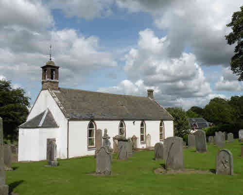
Kirkurd is a rural parish on the western boundary of the County of Peebles. It is bounded on the north by West Linton and Newlands with Stobo to the east and Broughton & Skirling to the south. The original parish church is a ruin within the policies of Castlecraig. The current building was erected in 1766. The parish war memorial is a conical stone structure outside the village near the A701. The parishes of Kirkurd and Newlands have been combined and this new parish is linked with West Linton
Old Parish Records cover the periods:
Births: 1705-1854 (Mothers' names are not recorded)
Map of Kirkurd from UK Great Britain, Ordnance Survey one-inch to the mile (1:63,360), 'Hills' edition, 1885-1903 by kind permission of the National Library of Scotland. Use the control at the top left of the map to zoom in or out and drag the map left, right, up, or down as you wish.
Map of Kirkurd from UK Ordnance Survey Historical Maps from 1919-1947 by kind permission of the National Library of Scotland. Use the control at the top left of the map to zoom in or out and drag the map left, right, up, or down as you wish.
Other Sources
The Buildings of Scotland - Borders, Cruft, Dunbar & Fawcett, Yale University Press, London 2006
The Statistical Accounts of Scotland 1791-99 vol.10 p.177 :
Kirkhurd, County of Peebles
The Statistical Accounts of Scotland 1834-45 vol.3 p.127 :
Kirkhurd, County of Peebles