The united Parishes of Whitsome and Hilton are situated in south east Berwickshire, being bounded on the north by the Parishes of Edrom and Hutton, on the east
by the Parish of Hutton, on the south by the Parishes of Ladykirk and Swinton and on the west by the Parishes of Swinton and Edrom.
Old Parish Birth Records exist from 1724 to 1854.
Marriage Records exist from 1762 to 1854.
Death records exist from 1784 to 1790.
1841 census Whitsome.
1851 census Whitsome.
1861 census Whitsome.
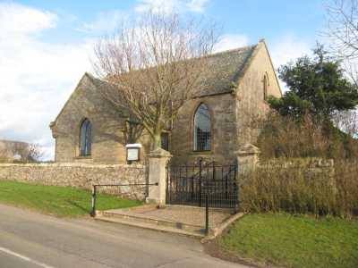
Whitsome Parish Church
See our sales list for full details and cost of postage.
Volumes available for consultation within our Archive
Article: History of Whitsome by Lesley A Robertson.
Pre 1855 Memorial inscriptions of Berwickshire by David Cargill.
The Churches and Churchyards of Berwickshire by G.A.C. Binnie.
CD The Churches and Churchyards of Berwickshire by James Robson 1896.
Index to Particular Register of Sasines for Berwickshire.
Pigot's 1837 Directory of Berwickshire and Roxburghshire.
Rutherford's Southern Counties Register and Directory 1867.
CD Slater's Directory of Berwickshire 1903.
County Directory of Scotland 1912 - Borders Towns and Villages.
Other
Title deeds relating to land at Whitsome - particularly the Heriot, Cunningham and Weatherall families.
Magazine Articles
Please note that the heading Author includes persons who have compiled or transcribed records; and that the topics indexed, and the synopses are subjective opinions. See the Sales List to buy copies of the magazines containing articles in which you're interested.
Title
Synopsis
Size Description
Issue No
Author
Ontario Genealogical Society summer camp
Where to research in Ontario for your Canadian cousins.
2 pages or more
37
D. C. Jeffrey
Map of Whitsome from UK Great Britain, Ordnance Survey one-inch to the mile (1:63,360), 'Hills' edition, 1885-1903 by kind permission of the National Library of Scotland. Use the control at the top left of the map to zoom in or out and drag the map left, right, up, or down as you wish.
Map of Whitsome from UK Ordnance Survey Historical Maps from 1919-1947 by kind permission of the National Library of Scotland. Use the control at the top left of the map to zoom in or out and drag the map left, right, up, or down as you wish.
The Scottish National Archives, Edinburgh hold the following records;
Whitsome Parish Church;
Minutes; 1834 to 1844, 1847 to 1870 ref CH2/977.
also the following maps
Plan of Easter Laws and Ravelaw (19th. century) ref; RHP.1207.
Plan of Whitsome Newton 1823 ref; RHP.3625/1-2.
Berwickshire Naturalists' Club has printed the following articles
Vols. 37 and 40 Whitsome and Hilton.
Vol. 36 Ministers of the 17th. century.
Vol. 36 Whitsome Parish School.
Vol. 39 Eight husbandland of Whitsome.
Vol. 40 Resurrectionists' Watch Tower.
Websites
Whitsome Website
contains photographs and transcriptions of gravestones in Whitsome Churchyard (under the link 'The old Kirkyard') plus much background information on the Parish.
The Statistical Accounts of Scotland compiled initially between 1791 and 1799, with a subsequent edition between 1834 and 1845 are a valuable record of the geography, history, economy, people and customs recorded by local ministers. You'll need to search for the parish name.
Farm Horse tax 1797-1798.
Medical Officers of Health Reports 1891.
Land Ownership Commission Report 1872 -1873. (available on C.D. in Society Archives).
Place and Farm names in Census Records
1841 census: Whitsome, Laws, Newton, Ravelaw, Longrigg, Whitsomehill, Laws, Leetside, Herriot Bank,
Dykethead, Hilton, Wynnfield, Jardinfield, Eaglehall, Frenchlaw. 1851 census: Whitsome, Herriotbank, Leetside, Frenchlaw,
Dykethead, Muirhouse, Hilton, Wynnfield,
Jardinfield, Eagle-hall. Red Row, Whitsome Hill, East Newton, West Newton, Laws Muir, Wester Laws, Ravelaw, Langrig, Heritage. 1861 census: Whitsome, Harriat Bank, Leetside, Frenchlaw, Dykethead, Hilton. Muir House, Winfield, Jardenfield,
Red Row, Whitsomehill, East Newton, West Newton, Southlaws, Whitsomelaws, Ravelaw, Langrigg, Heritage,
Crofts.
Population
The population has been recorded as follows: 1755 - 399, 1801 - 560, 1811 - 536,
1821 - 661, 1831 - 664, 1841 - 622, 1851 - 612, 1861 - 1067.