Our archive and search room is now open on Tuesdays and Thursdays from 10am to 4pm. Keep up to date via our Facebook page and Twitter.
Traquair
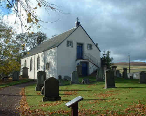
Traquair Parish is situated in the west of Peeblesshire being bounded on the north by the Parish of Innerleithen, on the east and south by the Parish of Yarrow in Selkirkshire and on the west by the Parish of Peebles. In 2000 it became part of the Parish of Innerleithen, Traquair and Walkerburn.
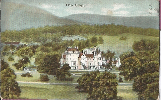
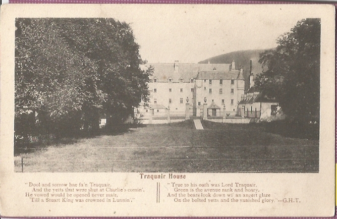
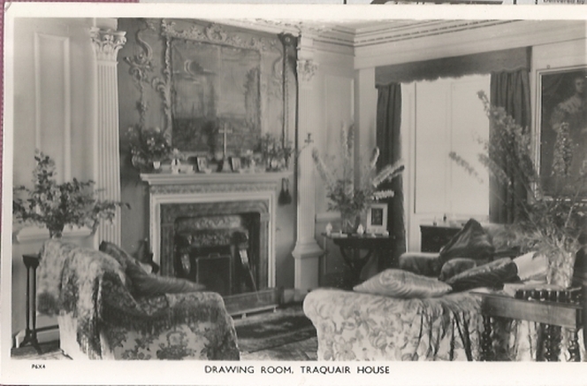
Traquair House is the oldest inhabited house in Scotland and the lairds were long time supporters of the Stewart Monarchy.
Old Parish Records cover the periods:
Births: - 1694 to 1854. (Mothers' names are rarely recorded)
CD Traquair and Kailzie Vol 1 Peeblesshire Monumental Inscriptions (includes Militia List, School Records 1872 - 1876, War Memorial transcription. list of ministers and maps of 1859)
Parish of Traquair Deaths 1818-1854 by Nigel Hardie
See our sales list for full details and cost of postage.
Volumes available for consultation within our Archive
A family life revealed - the Stuarts of Traquair 1491 -1875 by Catherine Maxwell-Stuart
County Directory of Scotland 1912 - Borders Towns and Villages
Innerleithen and Traquair - Ancient and Modern by H Anderson
Old Innerleithen, Walkerburn and Traquair by Alex. F Young published by Stenlake Publishing Ltd
Pre 1855 Monumental Inscriptions of Peeblesshire by S.A. Scott published by Scottish Genealogical Society 1971
Rutherford's Southern Counties Register and Directory 1867
School admissions: Traquair, Glen and Kirkburn - loose leaf print-out
Traquair by Catherine Maxwell Stuart
Traquair House - An Historical Survey by Stuart P Maxwell
Magazine Articles
Please note that the heading Author includes persons who have compiled or transcribed records; and that the topics indexed, and the synopses are subjective opinions. See the Sales List to buy copies of the magazines containing articles in which you're interested.
Title
Synopsis
Size Description
Issue No
Author
Glimpses of Old Innerleithen and Traquair
Notes on the book ' Glimpses of Old Innerleithen and Traquair' published by Innerleithen Civic Association in 1989, a copy of which has been acquired for the Society Archives.
less than 1 page
97
Extracts from the Register of the Privy Council of Scotland
Extract from the Register of the Privy Council of Scotland by David Masson.
less than 1 page
97
Gregory Lauder-Frost
Hope Family
Link to the website of the Hope family of Traquair, Tweedsmuir and West Calder.
less than 1 page
98
Innerleithen News
Book review. Author: Thomas Dobson. "Reminiscences of Innerleithen and Traquair" published 1896. The author recalls life in Innerleithen and accounts passed down from his grandparents going back to Napoleonic times. Many individuals are mentioned in the summary. Also a mention of a recent CD published on Innerleithen Shops.
1 page or more
107
Ronald Morrison
The poor, crime and punishment, and the power of the Kirk in the Borders, 17th and 18th Centuries
When paupers died, the contents of their houses were sold by public group. This is an account of one sale and the strength of the Kirk.
2 pages or more
31
M. C. Lawson
Border Suffragettes
Article of Border Suffragettes.
less than 1 page
98
Ronald Morrison
Shillinglaw Walls
Shillinglaw Tower not far from Traquair it is not only a heap of stones - an interesting tale.
2 pages or more
38
Jean Shillinglaw Ridley
Map of Traquair from UK Great Britain, Ordnance Survey one-inch to the mile (1:63,360), 'Hills' edition, 1885-1903 by kind permission of the National Library of Scotland. Use the control at the top left of the map to zoom in or out and drag the map left, right, up, or down as you wish.
Map of Traquair from UK Ordnance Survey Historical Maps from 1919-1947 by kind permission of the National Library of Scotland. Use the control at the top left of the map to zoom in or out and drag the map left, right, up, or down as you wish.
20 Most Common Surnames
The 20 most common surnames on gravestones recorded by us in the Traquair and Kailzie monumental inscriptions volume are (number of gravestones in brackets): SCOTT (17), BROWN (14), DALGLEISH (10), ANDERSON (10), TENNANT (8), WILSON (8), NICOL (8), TAIT (8), BRODIE (7), BALLANTYNE (7), JACKSON (6), SMITH (6), BELL (5), MELROSE (5), PATERSON (5), MILLER (5), DOUGLAS (5), LITTLE (5), HOPE (5), WILLIAMSON (4).
Other Sources
The Buildings of Scotland - Borders, Cruft, Dunbar & Fawcett, Yale University Press, London 2006
Reminiscences of Innerleithen and Traquair by T Dobson - Innerleithen 1896
The Cleikum being interesting reminiscences of Old Innerleithen by J.A. Anderson - Galashiels 1933
Innerleithen and Traquair , Ancient and Modern by H Anderson - Bognor Regis 1984
The Statistical Accounts of Scotland compiled initially between 1791 and 1799, with a subsequent edition between 1834 and 1845 are a valuable record of the geography, history, economy, people and customs recorded by local ministers. You'll need to search for the parish name
So far as we are aware, the copyright on these pictures has expired.
However, if you wish us to remove the images and you can demonstrate that you hold the copyright, please contact us.