Our archive and search room is now open on Tuesdays and Thursdays from 10am to 4pm. Keep up to date via our Facebook page and Twitter.
Manor
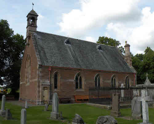
Manor Parish - sometimes referred to as Kirkton Manor - is situated in the County of Peebles being bounded on the north and east by the parish of Peebles, on the south by the Selkirkshire Parish of Yarrow and on the west by the Parish of Drumelzier and on the north-west by the Parish of Stobo. The parish is located along the valley of Manor Water, a tributary of the River Tweed and is now part of the combined parish of Lyne & Manor despite the absence of a common boundary. Much of the original parish is upland moor.
County Directory of Scotland 1912 - Borders Towns and Villages
Pre 1855 Monumental Inscriptions of Peeblesshire
Rutherford's Southern Counties Register and Directory 1867
The Source of Manor
Magazine Articles
Please note that the heading Author includes persons who have compiled or transcribed records; and that the topics indexed, and the synopses are subjective opinions. See the Sales List to buy copies of the magazines containing articles in which you're interested.
Title
Synopsis
Size Description
Issue No
Author
Gordian Cross Tweeddale
Some notes on the Gordian Cross in the Manor Valley Tweeddale.
less than 1 page
94
Howard Kennedy
Lyne , Megget and Manor Monumental Inscriptions
Some notes on the CD of Monumental Inscriptions and other records of Lyne, Megget and Manor, published by the Society.
1 page or more
88
Map of Manor from UK Great Britain, Ordnance Survey one-inch to the mile (1:63,360), 'Hills' edition, 1885-1903 by kind permission of the National Library of Scotland. Use the control at the top left of the map to zoom in or out and drag the map left, right, up, or down as you wish.
Map of Manor from UK Ordnance Survey Historical Maps from 1919-1947 by kind permission of the National Library of Scotland. Use the control at the top left of the map to zoom in or out and drag the map left, right, up, or down as you wish.
20 Most Common Surnames
The 20 most common surnames on gravestones recorded by us in the Lyne, Megget & Manor monumental inscriptions volume are (number of gravestones in brackets): BURNETT (27), ANDERSON (19), HORSBURGH (18), RITCHIE (17), MITCHELL (16), TOD (15), SCOTT (13), MELROSE (13), JOHNSTON (13), STEWART (13), SMITH (12), TODD (12), PROUDFOOT (11), GRAY (11), LITTLE (10), VEITCH (10), WILSON (9), THOMSON (9), TAIT (8), BROWN (8).
Other Sources
The source of Manor by Lyne and Manor Youth Group 1999
The Buildings of Scotland
The Statistical Accounts of Scotland compiled initially between 1791 and 1799, with a subsequent edition between 1834 and 1845 are a valuable record of the geography, history, economy, people and customs recorded by local ministers. You'll need to search for the parish name.